hydro-terminus
columbia university, GSAPPfall 2014 seminar
a series of mapping exercises exploring the complex water politics that have defined new borders and nationalities and have re-determined privileges of access to water.
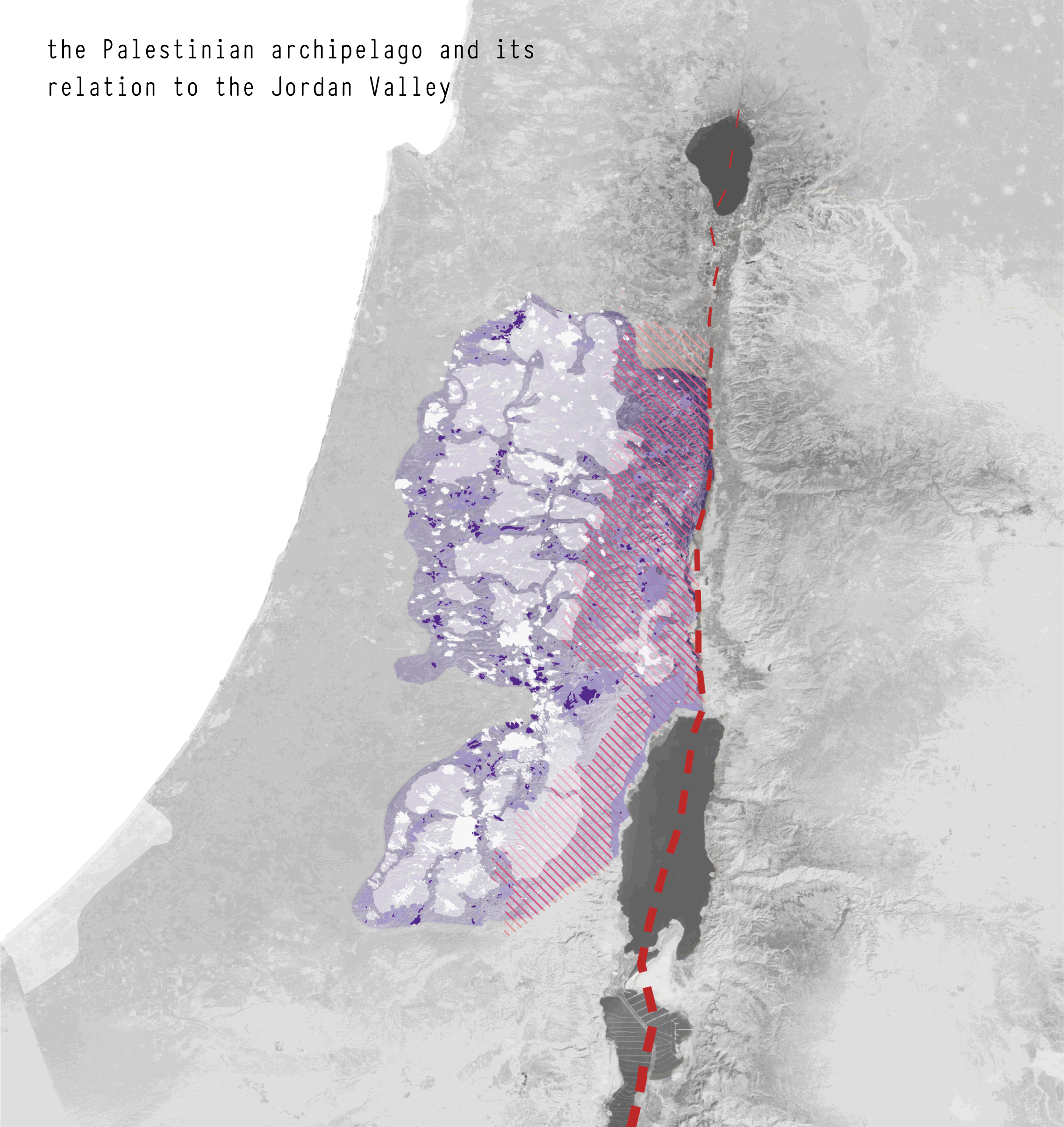
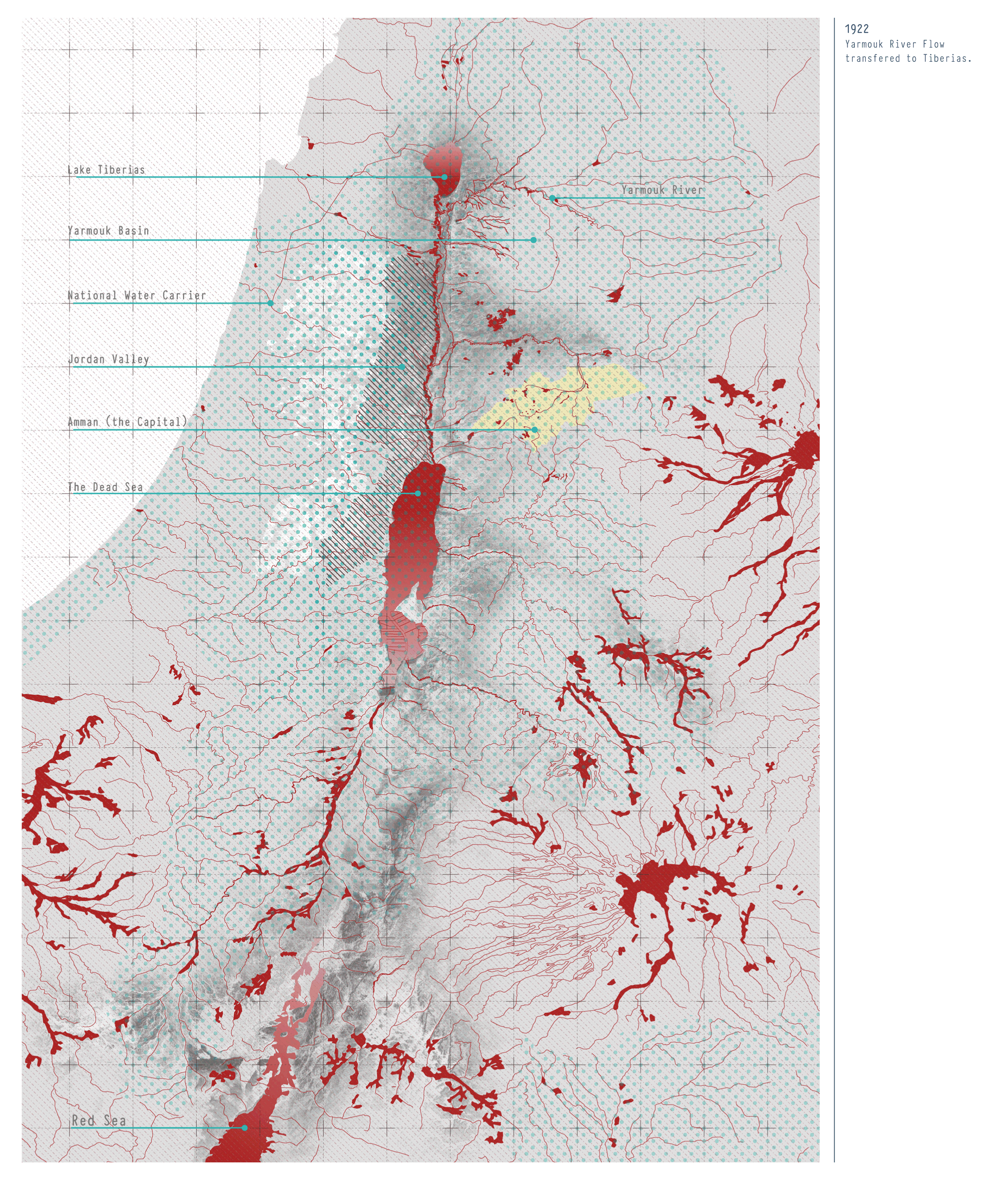
as water scarcity around the world and in the Middle East continues to challenge inhabitants, conflicts for the right of access to water escalate, whether international hydro-tensions or interior water availability issues. Water is one of the most precious resources in some of the world’s driest lands, and competition over the access to what is available begins to beg for better resolutions. The geography of the Middle East, most specifically the Levant area, is historically, theologically and politically unique. The Jordan River basin is shared between Jordan, Syria, Palestine, the Israeli regime, and Lebanon and is a site that is not only geographically significant, but has been a witness to numerous mono-theistic miracles, disputes of water rights, colonial and tribal conflicts and a few resolutions.
The project looks at the Jordan Valley’s colonial history, before and after Sykes-Picot as a pivotal moment that redetermined ideas of nationality and belonging, as well as the access to valuable resources like water.
From looking at the existing natural basins and aquifers, the ever-dwindling Dead Sea, to the politically and envrionmentally motivated water conveyance projects such as the Red Sea-Dead Sea conveyance project, the maps attempts to understand the lineage of this aquatic border, its politics, and how it connects to the rest of Jordan.
research | mapping
studio: echoing borders with adv. nora akawi, nina kolowratnik, madeeha merchant